Rethinking Healthy Cities. Urban health as enacted, negotiated and dynamic. Global Centre on Healthcare and Urbanisation, University of Oxford, 2026, Oxford, UK.
New parenthood, walking and parental health: Empirical evidence from Aotearoa New Zealand. State of the Australasian Cities Conference (SOAC), 2025, Brisbane, Australia.
Care-in-motion: Rethinking walking, health and the planning of urban environments for new parents. International Conference on Urban Health (ICUH), 2025, Wellington, New Zealand.
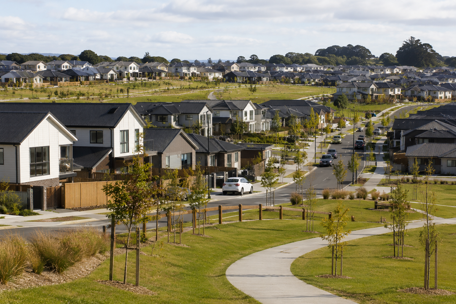
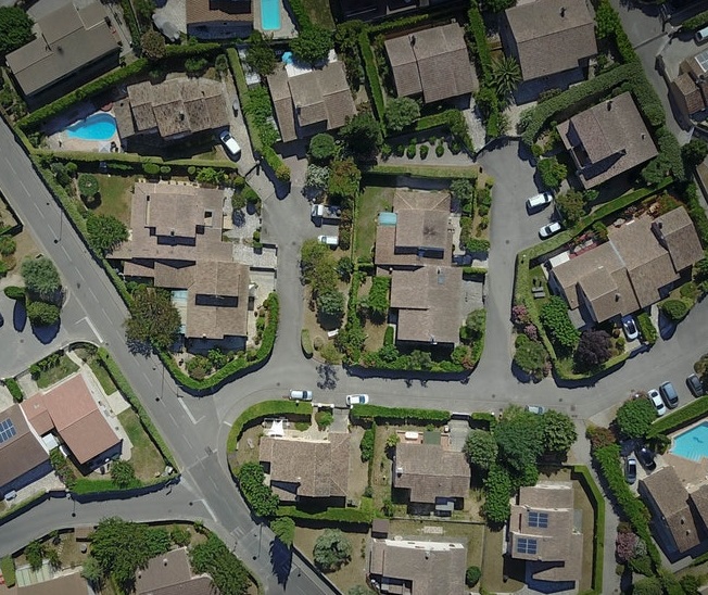
Towards healthier (sub)urban geographies for new parents. Urban Transitions Conference, 2024, Sitges, Spain.
Social inequity in urban forest benefits. Urban Forest Futures New Zealand Symposium, 2024, Christchurch, New Zealand.
Belonging through placemaking: Healthy local geographies for new parents living in suburban Aotearoa. SOAC Conference, 2023, Wellington, New Zealand.
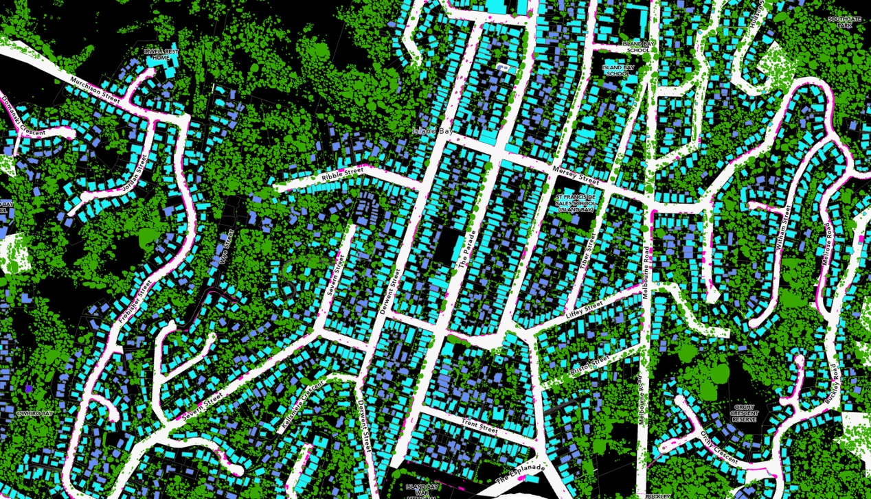
Nature orientation and opportunity: A spatial analysis of who values and who has opportunity for satisfactory green spaces in proximity to their place of residence. New Zealand Geographical Society Conference, 2022, Christchurch, New Zealand.
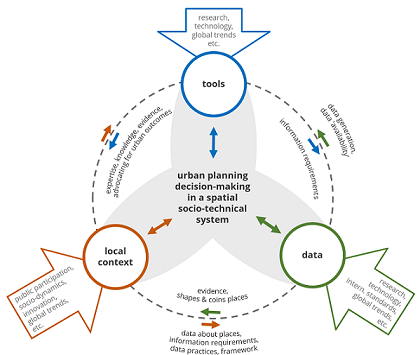
Planning healthy cities – Navigating socio-technical interactions. VUW, 2022, Wellington, New Zealand.
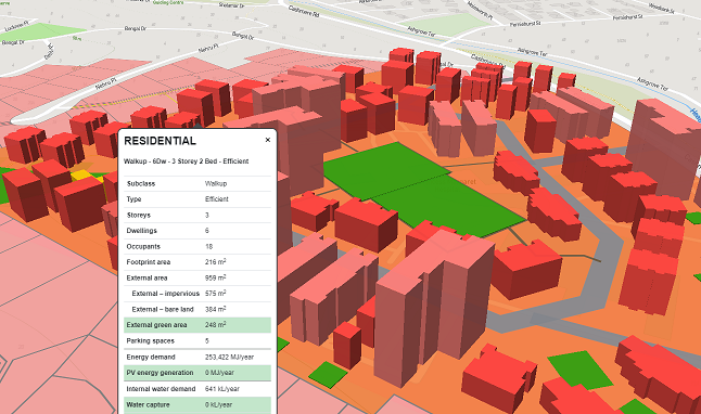
Developing and implementing geospatial urban planning decision-support tools - Learnings from Aotearoa New Zealand. GeoComputation, 2019, Queenstown, New Zealand.
How far do people travel to use urban green space - A view from three European Cities. ECTQG, 2019, Luxembourg.
A geospatial decision-support tool to contrast energetic outcomes, CO2 emissions, water management and socio-economic outcomes of urban areas. EGU, 2019, Vienna, Austria.
A critical reflection on the implications of the use of urban decision-support tools on urban outcomes. Regional Studies Association Conference, 2019, University of Canterbury, Christchurch, New Zealand.
The role of decision-support tools in New Zealand’s urban planning. ANZAPS Conference, 2018, University of Waikato, Hamilton, New Zealand.
Local context matters – Challenges of spatial planning tools in New Zealand. New Zealand Geographical Society and Institute of Australian Geographers Conference, 2018, University of Auckland, Auckland, New Zealand.
A multi-level perspective of New Zealand’s spatial data ecosystem: Needs, barriers and initiatives among the spatial planning community. New Zealand Geospatial Research Conference, 2017, University of Canterbury, Christchurch, New Zealand.
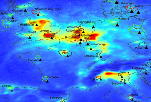
Emitting or being exposed? A policy comparison of spatial equity in a city with traffic pollution. Invited speaker at the NECTAR workshop Smart Cities - Governing Accessibility, Air Pollution and Equity, 2017, Sao Paulo, Brasil.
An agent-based model to simulate feedback effects between traffic-induced air pollution and urban structure. International Symposium on Cellular Automata Modelling for Urban and Spatial Systems (CAMUSS), 2016, Quebec, Canada.
Optimum city structure and equity in a city with local traffic-induced air pollution. North American Regional Science Association Conference (NARSC), 2015, Portland, USA.
Modelling urban structure and exposure to traffic-induced air pollution. Invited speaker at UrbMod Workshop – Towards Modelling the Urban System, 2016, University of Hamburg, Germany.
Spatial implications of endogenous pollution externalities in a residential location model. ERSA Conference, 2014, St. Petersburg, Russia.
Locational and socio-economic sorting in the use of green space: Evidence from Brussels. Annual meeting of the Association of American Geographers (AAG), 2017, Boston, USA.
Effects of residential preferences and structures on population exposure to air pollution. Invited speaker at Journée Thématique: La ville et l’environment, INRA CESAER, 2013, Dijon, France.
Traffic-induced air pollution concerns and policy design – Impact analysis on urban structure and distance-related exposure equity. Sommerkonferenz zur Regionalforschung, 2015, Kiel, Germany.